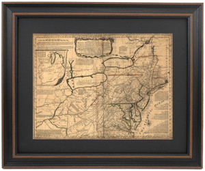
Historical 1746 Post Route Map by Herman Moll
Patriot Gear
$149.76
Product Overview:
- Proudly handmade in the USA
- Wood frame with mat, glass front, paper duster backing with wire hanger
- Top quality digital print (not printed on parchment like many of our offerings)
- Standard size frame measures approx. 24" wide x19 1/2" tall
- Poster size frame measures approx. 36" wide x 29 1/2"" tall
Product Details:
This is a reproduction of Herman Moll's Post Route Map from 1746. It shows the early postal routes for mail delivery in New England, New York, New Jersey and Pennsylvania. Study in amazement at the early spelling of today's towns and landmarks. The texts lays out the schedule for when each mail runs start and where they make drops along their routes.

We stand behind the quality and craftsmanship of our products.


