


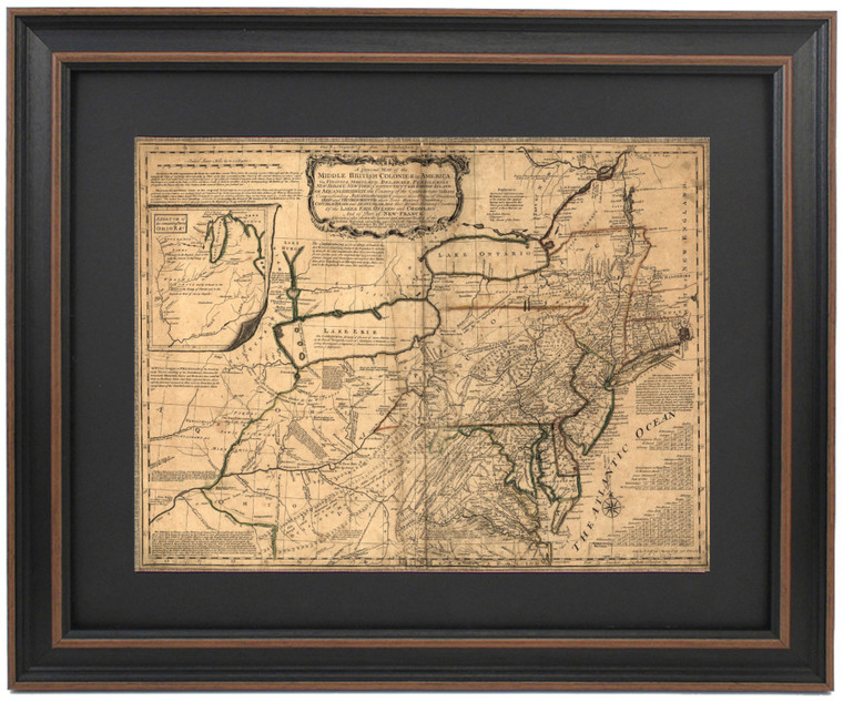
Middle British Colonies in America 1758 Historical Map
Patriot Gear
$149.76
(No reviews yet)

Write a Review
Patriot Gear
Middle British Colonies in America 1758 Historical Map
Product Overview:
- Proudly handmade in the USA
- Wood frame with mat, glass front, paper duster backing with wire hanger
- Top quality digital print (not printed on parchment like many of our offerings)
- Standard size frame measures approx. 24" wide x 17 1/2" tall
- Poster size framed measures approx. 36" wide x 26" tall
Product Details:
This is a reproduction of the Middle British Colonies in America from 1758. It shows a general map of the middle British colonies in America: Virginia, Maryland, Delaware, Pensilvania, New-Jersey, New-York, Connecticut and Rhode-Island: Of Aquanishuonigy the country of the confederate Indians comprehending Aquanishuonigy proper, their places of residence, Ohio and Thuchsochruntie their deer hunting countries, Couchsachrage and Skaniadarade their beaver hunting countries, of the Lakes Erie, Ontario and Champlain, and of part of New France: Wherein is also shown the ancient and present seats of the Indian nations.

We stand behind the quality and craftsmanship of our products.


